Discover the Beauty of Mount Cameroon
A fault, running nearly NE-SW between two major African plates, is the origin of Mount Cameroon and other mountains on the Cameroon Volcanic Line, running 1600 km long between Annobon island in the Atlantic Ocean and Ngaoundere Plateau inland.
The line is interpreted as the Central African Shear zone. Thus Mount Cameroon cannot be regarded only as a volcanco but as a volcano-tectonic fet (2009).
40 km to the SW of Mount Cameroon is the island of Bioko with the Pico Basile (3011m), geologically and botanically a twin of Mt Cameroon (both mountains were linked 10,000 years ago by land before the sea level rose).
Moving NW from Mount Cameroon, 100 km along the fault is Mount Kupe (2064m), highest point of the Bakossi Mountains, followed by the Manenguba Massif with a peak at 2411 m, the Bambouto Mountains (peak at 2740m), Mount Oku (3011 m) in the Bamenda Highlands and further inland more mountain ranges.
Mount Cameroon is a volcanic massif 50 km long and 35 km large oriented in NE – SW direction.The heart of Mount Cameroon and Mount Etinde (“small Mount Cameroon”) was formed by volcanic activities through rising of basalts since 80 million years ago.
More volcanic activity took part in the Quaternary (2.5 million years ago until present) building the bulk of the main massif and creating also the crater lakes at the foothills of Mount Cameroon (Debundscha, Njonji crater lakes in the South West and Barombi Koto in the North) .
The surface of the massif is formed by more than 140 recent volcanic scoria and cinder cones, created by explosive eruptions, and of lava flows. There are also some effusive volcanic mouths without cones linked to fractures.
Mount Cameroon has the most frequent eruptions of any West African volcano.
The first written account of volcanic activity could be the one from the Carthaginian Hanno the Navigator, who might have observed the mountain in the 5th century BC. He described the mountain as the “Chariot of the Gods”. Moderate explosive and effusive eruptions have occurred throughout history from both summit and flank vents Mount Cameroon is the only active volcano of the Cameroon Line and erupting roughly every twenty years.
There have been seven major eruptions recorded in the 20th Century: 1909, 1922, 1954, 1959, 1982, 1999 and 2000. The 1922 eruption on the southwestern flank produced a lava flow that reached the Atlantic coast at Idenau destroying the village of Bibundi, and a lava flow from a 1999 south-flank eruption stopped only 200 m from the sea, cutting the coastal highway close to Bakingili.
Climate
Mount Cameroon has a tropical seasonal climate, with one wet and one dry season. With the shift of the Inter-Tropical Convergence Zone (ITCZ), where winds from the northern and southern hemispheres meet, the area is at different times of year under the influence of either continental stable, cool and often dust laden winds from the North-East (Harmattan) or maritime moist, warm and unstable winds from the South-West (monsoon).
At the west coast the high rainfalls are the result of the moist air forced to rise in a short distance up and over the slopes of the mountain. Debundscha at Cape Nachtigall is the third wettest place on earth and receives 10 m of rainfall. On the rain shadow site of the mountain – the NE slopes – rainfall is only 2 m.
Rainfall tends to decrease with altitude on the mountain, the upper part of the mountain only receive 3 m per year, while the topmost part , around the peak, receives only 2 m of rain per year.
The rainy season begins in April but earlier rainfalls are not rare. The moisture-laden winds from the Atlantic Ocean bring the rains delivered from cloudbursts, accompanied by intense electrical storms and high winds.
By June or July rain falls almost continuously but less intense. (Fraser et al, 1998). The upper limits of the mountain (over 3050m) are swept by North East trade winds, which have a night temperature slightly under freezing point and little more than 5°C during the day. This forms a “condenser” on the top of the mountain. The warm air is rapidly cooled thus causing a fog and cloud which surrounds Buea and the villages on and above the 900m (Zielewska, 2004).
Air temperature is more or less constant throughout the year. Mean daily temperature drops 1 or 2°C in the wet season, but diurnal temperature variation is greater than seasonal differences (Fraser et al., 1998). Temperatures on the mountain decrease with altitude (0.6°C per 100 m height difference). E.g.
Temperatures at Fako Mountain lodge (2800 m asl) varies between 5°C (Min) and 16° (Max). At the summit temperatures go down to 1-5°C. Strong cold winds are blowing on the upper part of the mountain.
The dry season runs from November to March, and is ideal for hiking in the Park without much rain, though visibility is partly negatively impacted between January and March when the Harmattan winds from the Sahara bring dust. However the summit stands over the dust which forms a layer between 1000 and 3000 m. Best visibility and still apt for hiking are the transition periods from the rainy to dry season October/November/December and from dry to rainy season April/May/June.
Landscape and vegetation types
- The Mount Cameroon Region offers an outstanding diversity of landscapes, vegetations, habitat types and ecosystems: from lowland and mountain rainforest to grasslands and volcanic “lunar” landscapes.
- With clear atmospheric conditions you have splendid views to Bioko island (Equatorial Guinea) just 40 km over the ocean with the volcano Pico Basile (3011 m) and to all the coast line between Debundscha, Limbe and the mangroves up to Douala.
- It can be guaranteed to the visitor that on the mountain he is discovering astonishing new surroundings and sceneries qualified by some as majestic, magic , mystical.
- The western slope of Mount Cameroon is the only area in West and Central Africa where there is an unbroken vegetation gradient from evergreen lowland rainforest at sea-level, through montane forest, to montane grassland and alpine grassland near its summit.
- This link between ecosystems largely accounts for the biological diversity of the region.
There are five vegetation types on the mountain, all of which provide different experiences for visitors:
- Lowland and Evergreen Rain Forest (O-800 m)
- Sub-montane Forest (800-1600 m)
- Montane Forest (1600- 2500 m)
- Montane grass land and scrubs (1800- 3000m)
- Sub-alpine prairie/ grassland (3300- 4070 m)
The lowland forest occurs in patches in the western slopes of the mountain and is heavily affected by human activities (agriculture and illegal timber exploitation).
This species-rich forest consists mainly of evergreen tall trees (25 – 35 m) forming a dense and fairly continuous canopy with large emergent trees poking through it.
Many emergent and canopy trees have buttresses and a number of small trees and shrubs bear their flowers directly on the trunk or larger branches.
This flower habit known as cauliflory, as well as buttressing are highly characteristic of the lowland rainforest.
Beneath the tree layer, are shrubs, tall herbs and a ground layer consisting of seedlings, low-herbs and ferns. The lower trees are usually connected by large lianas.
The lowland forest usually gives way gradually to sub-montane vegetation between 800-1,600m, dominated by either a closed canopy forest or a discontinuous canopy forest with considerable patches of natural meadows and scrubs. It is characterised by a low canopy (20-25m) with scattered large trees (up to 35m tall).
Although, less diverse and less tall than the lowland forest, it is richer in epiphytes and tree ferns. Because of the heavy mist, the greater cloud cover and the consequent high humidity that envelop this forest for long periods, the sub-montane forest is also called “cloud forest” or "Mist forest". Such conditions allow for the development of a rich epiphytic flora. Above 1,500m trees are intensively covered by bryophytes, mosses, lichen and vascular epiphytes including ferns and orchids. The herb layer is also very rich in terrestrial ferns.
Characteristic species are tree ferns (Cyathea manneana and C. camerooniana) and large strangler figs. Patches of meadows and scrubland dominated by dense tall herbs (2m) with scattered shrubby trees and tree ferns also occur in the sub-montane forest especially on fairly deep soils. They are usually dominated by Hypselodelphys scandens which are often associated with species of Aframomum and Marantochloa.
This type of forest main present on the western slope is also called “Elephant bush” by the local community. It is much favoured and maintained by the presence of elephants on the mountain. In the absence of Hypselodelphys, areas of scrubland are dominated by a dense stand of scarcely woody monocarpic Acanthaceae (Mimulopsis solmsii, Oreacanthus mannii and Brillantaisia sp.), and Labiatae (Plectranthus insignis), dense tall herbs (e.g. Aframomum spp. and Melanthera scandens), and by tangles of herbaceous climbers. Part of the forest at lower altitudes outside the park (Buea) transformed into agricultural use.
The transition from sub-montane to montane forest is gradual and occurs around 1,600-1,800m.
Although well developed, the montane forest is of limited extent and gives way either abruptly or with a transitional belt of fire-resistant scrubs to montane grassland at about 2,000-3,000m.
The montane forest is species-poor, apparently drier and has less cloud cover.
The forest is more open and irregular in structure, with either one or two layers of trees, both very irregularly distributed.
The trees are smaller, 15-20m high and are characteristically festooned with epiphytes and mosses. Typical tree species are: Schefflera abyssinica, S. mannii, Prunus africana, Rapanea melanophlaeos, Xymalos monospora, Hypericum revolutum, Clausena anisata, and Nuxia congesta.
The montane grassland is dominated by tall grasses (1-2m high) with scattered stunted, gnarled and dwarfed trees, and enclaves of woodland or thicket in gullies and rocky areas which act as natural fire breaks.
This montane tall-grassland is always very colourful with many beautiful flowering herbs and shrubs. Most of this zone, as well as the subalpine zone are subject to frequent burning.
This vegetation type is dominated by tall tussock grasses of which Loudetia camerunensis, Andropogon lima and Pennisetum monostigma are the most characteristic. They are commonly associated with Indigofera alatipes, Cyanotis barbata, Trifolium simense, Kyllinga odorata, Hypoxis camerooniana, Swertia abyssinica, Holothrix tridentata, and Habenaria spp. Occasionally, scattered small trees or shrubs such as Agauria salicifolia, Myrica arborea, Pentas schimperiana, Hypericum lanceolatum, Adenocarpus mannii, Philippia mannii, and Satureja robusta occur here and there in gullies and bushes.
The montane scrub does not form a continuous belt, but forms blocks or patches separated by grassland with scattered shrubs. Although, it is usually confined to the forest fringe (forest/grassland boundary), and especially protected gullies and craters, isolated fragments of scrubland also occur as high as 3,500m.
The montane woodland is poorly developed and the vegetation is rather open with fairly even or discontinuous canopy of small trees. Near the forest edge, the trees become dwarf and stunted, and do not usually exceed 10-15m height. The forest is also much drier and receives a low rainfall. As a result, montane scrub is very prone to damage by fire. Because this forest is extensively degraded by fire, montane scrub and forest edge species are common. They include Hypericum lanceolata, Maesa lanceolata, Agauria salicifolia, Myrica arborea, Lasiosiphon glaucus and Philippia mannii.
The sub-alpine grassland is dominated by short very thick dense tussock grasses, with isolated patches of dwarf and gnarled shrubby trees, cushions of mosses and thick crust foliose and fruticose lichen.
Grasses have narrow enrolled leaves and almost all plants are xerophytes. Common grass species include Deschampsia milbraedii, Agrostis mannii, Koeleria cristata, Festuca abyssinica, Bulbostylis erratica, B. capillaris, Andropogon distachyus, A. lima, A. mannii, A. amethystinus, Sporobolus montanus, Tripogon major, Silene biafrae, Aira caryophyllea, and Crepis camerooniana.
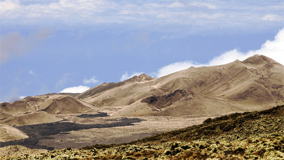
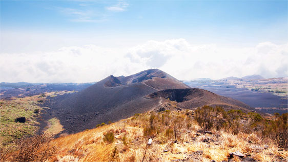
Trees are usually absent, Adenocarpus mannii and Blaeria mannii occur as high as 3,500m. Near the summit area above about 3,600m, the vegetation is sparse and the area has the appearance of a semi-desert.
The substratum is highly porous consisting of cindery lava flows of recent origin.
These harsh conditions account for the paucity of vascular species around the summit.
Colonisation is sparse, clear dominants are lacking, and only patches of mosses, lichens, short tuffs of the grass Pentaschistis mannii, and dwarf shrubby Ericaceous species (less than 15cm tall) such as Blaeria mannii and Philippia mannii, which are well adapted to withstand the extreme and prolonged desiccation can establish themselves.
Ecological succession of lava flows
On lava, different phases of the succession of plant formations can be observed, from pioneer species as algae, lichen, mosses, ferns and orchids. Later other more complex herbs and scrubs install at from 45 years onwards also small trees develop.